


The future of the Bangladesh-China-Myanmar Economic Corridor

“This is Burma, and it will be quite unlike any land you know about.”
— Rudyard Kipling, Letters from the East
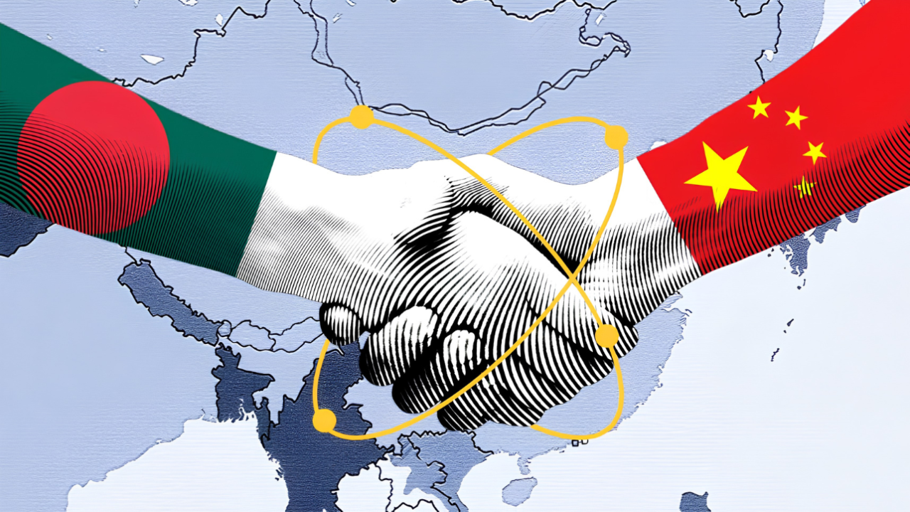
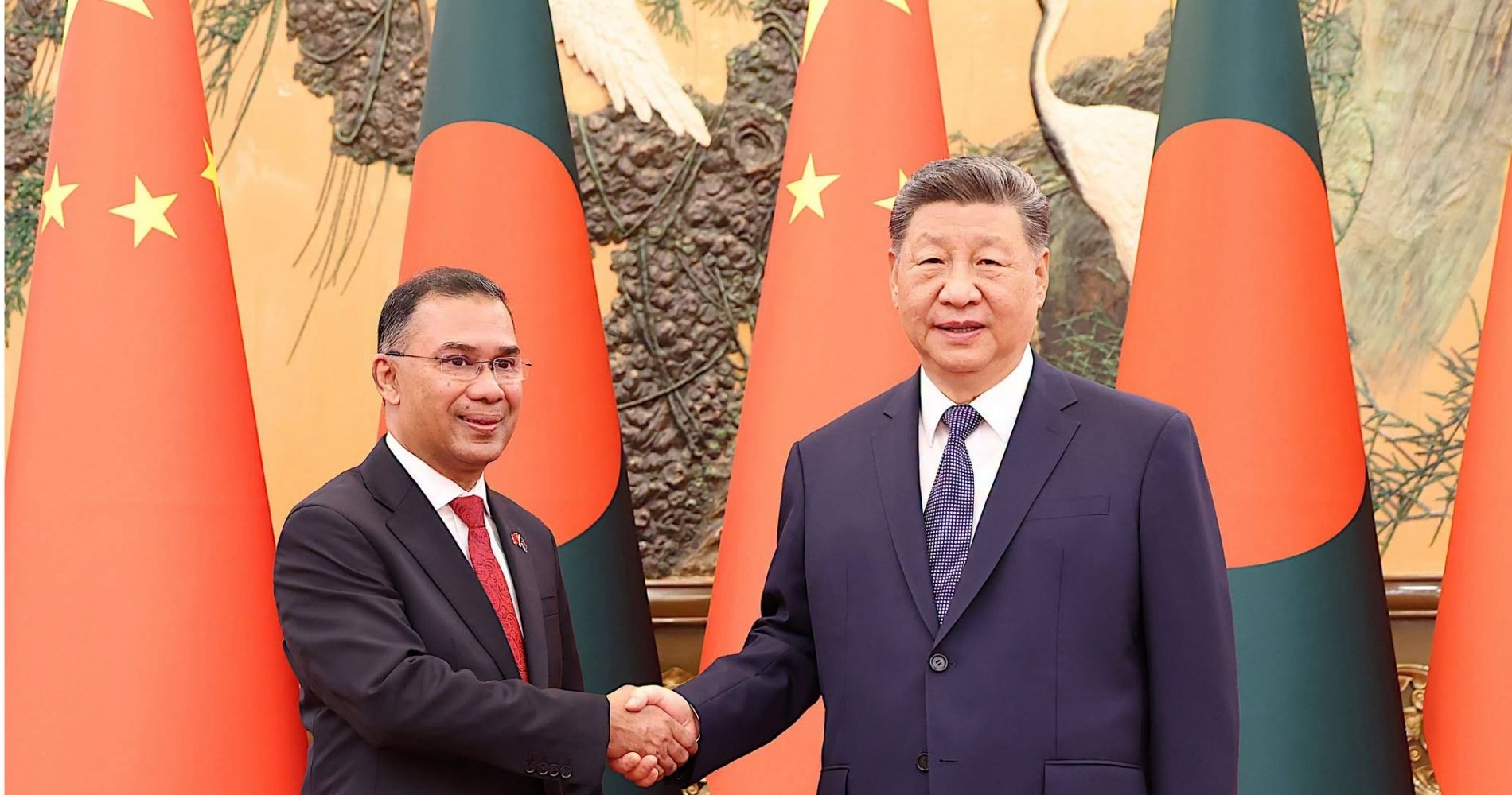
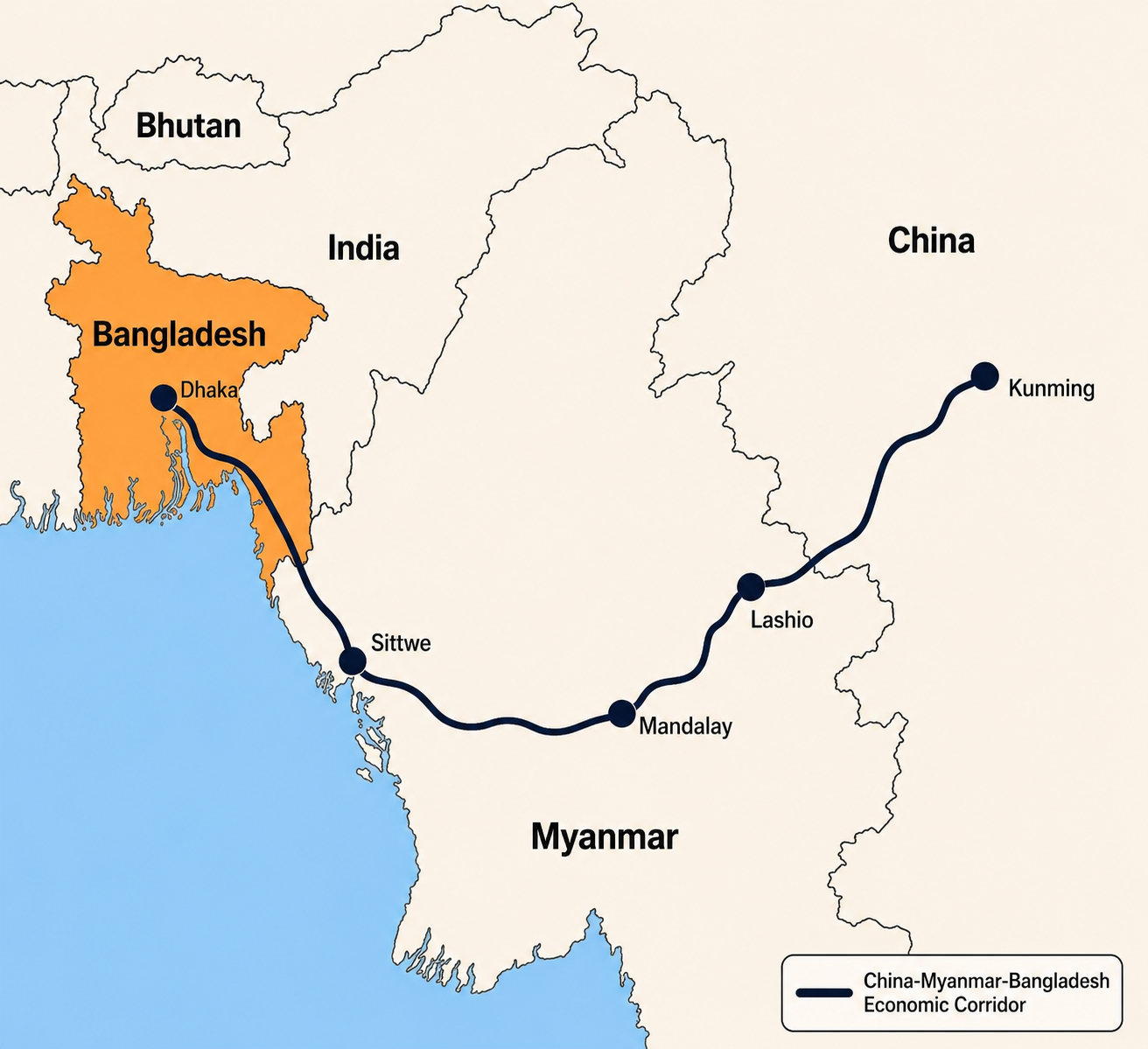
On June 26, 2026, during a meeting between Bangladeshi Prime Minister Tarique Rahman and Chinese President Xi Jinping, Beijing proposed the establishment of the Bangladesh-China-Myanmar Economic Corridor (BCMEC), a regional connectivity network that would form a pillar of the Chinese-financed Belt and Road Initiative (BRI) and link Bangladesh to landlocked southwest China via Myanmar. The proposed corridor is envisioned as a substitute for the stalled Bangladesh-China-India-Myanmar Economic Corridor (BCIMEC), which, if implemented, would have connected Bangladesh to China via India and Myanmar, but the project was shelved due to intensifying Sino-Indian strategic competition. Much has been written about the potential economic significance of the corridor; however, the viability of such a project is actually questionable.
While the exclusion of India from the proposed BCMEC removes an important source of friction, the implementation of the project would still be extremely difficult owing to the prevailing political situation in Myanmar, a 'shatterbelt' situated south of China and southeast of Bangladesh.
The term 'shatterbelt' was first used in the context of geography by prominent United States (US) geographer Richard Hartshorne in 1941, and in 1961, British geopolitician William Gordon East used it as a geopolitical concept for the first time. According to East, a 'shatterbelt' is a strategically important region marked by sharp cultural divisions of many kinds—ethnographic, linguistic, religious, economic, and political—and subject to intense competition among great powers.
The proposed BCMEC offers clear strategic and economic promise, but its implementation is likely to be constrained more by geopolitics than by infrastructure. Myanmar's prolonged civil war, fragmented territorial control, entrenched ethnic conflicts, and persistent great-power rivalry make the country an unstable transit state and a classic geopolitical shatterbelt. Any corridor traversing contested territory would face severe security, financial, and operational risks, undermining its long-term viability.
East identified East-Central Europe as a shatterbelt because the region was characterized by deep-rooted ethno-cultural conflicts and was a battleground for great powers—the Germanic states, Russia, France, the Devlet-i Aliye-i Osmaniye, and later the Anglo-Saxon powers—for centuries. Afterwards, a number of other geographical regions, including the Balkans, the Caucasus, the Middle East, the Bam-i-Dunya (Roof of the World), Southwest Asia, and the Horn of Africa, have also been identified as shatterbelts owing to their similar characteristics.
Shatterbelts are viewed as zones of political weakness, where central and/or governmental control is comparatively weak, intra-state, inter-ethnic, and inter-communal conflicts are frequent, and the opportunity for external interference and intervention is high. Consequently, chronic instability prevents states located in a shatterbelt from pursuing the goal of national development single-mindedly and leads them towards increased militarization and securitization. Since shatterbelts are conflict-prone and unstable, investments in these regions are risky from an economic perspective.
This has been well illustrated by the case of the China-Pakistan Economic Corridor (CPEC). A substantial part of this ambitious project, worth US$62 billion, is concentrated in Pakistan's Baluchistan Province, a shatterbelt plagued by a prolonged insurgency waged by Baluch nationalists and where a number of great and regional powers, including the US, China, India, and Iran, are engaged in an increasingly intense strategic competition. The Baluch nationalist military-political formations have targeted CPEC infrastructure and killed several Chinese citizens in their attacks, severely jeopardizing Chinese investments in the region. This clearly shows the risks of undertaking ambitious connectivity projects in a shatterbelt.
From a geopolitical perspective, Myanmar, along with India's northeastern states and Bangladesh's Chittagong Hill Tracts (CHT), constitutes a shatterbelt. The region has witnessed persistent ethnic, racial, religious, and political conflicts since its decolonization in 1947–1948. Myanmar's non-Bamar ethnic armed organizations (EAOs) have fought against the union government since 1948 for independence, autonomy, or substantial politico-economic rights, while the Tatmadaw (the Myanmar Armed Forces) has consistently competed with civilian political parties for state power, eventually leading to the creation of an entrenched 'garrison state' and culminating in the ongoing civil war. Similarly, ethnic and tribal groups in northeast India have fought against the union government and among themselves for decades. A smaller-scale but nonetheless acute conflict exists in Bangladesh's CHT. Due to the region's strategic location, several great and regional powers, including the US, China, Russia, Japan, and even Israel and Pakistan, have demonstrated keen interest in it.
In particular, Myanmar, which would constitute an essential link in the BCMEC, currently has all the hallmarks of a shatterbelt. It has two governments—the military-controlled union government and the oppositional National Unity Government (NUG). The union government currently controls between 20% and 33% of Myanmar's territory, while the remaining 67% to 80% is either controlled by the NUG and/or the EAOs or contested by both sides. Dozens of EAOs exist in Myanmar, and nearly all of them have sought to create their own ethnic statelets in their respective regions. For instance, the United Wa State Army (UWSA) exerts de facto independent control over Wa State—in the union government's terminology, the Wa Self-Administered Division—within Myanmar's Shan State. The Myanmar National Democratic Alliance Army (MNDAA) de facto governs the Kokang Self-Administered Zone within Shan State. Chin EAOs, including the Chin National Front (CNF), the Chin Brotherhood (CB), and the largely decentralised Chinland Defense Force (CDF), control more than 70% of Chin State, while the Arakan Army governs approximately 90% of Rakhine State, along with Paletwa Township in Chin State. Thus, Myanmar is highly fragmented, unstable, and faces the potential risk of Balkanization.
If Dhaka, Naypyidaw, and Beijing actually seek to implement the BCMEC, the corridor will pass through several regions of Myanmar that are not controlled, or are only partially controlled, by the union government. These regions include Rakhine State, Magway Region, Mandalay Region, Shan State, and possibly Chin State. As mentioned earlier, Rakhine, Chin, and Shan States are largely controlled by EAOs, while Magway and Mandalay Regions are split between the union government and the People's Defense Force (PDF), the military wing of the NUG. These regions are active battlefields, where non-Bamar ethnic groups and anti-junta Bamar people are locked in vicious conflict with the Bamar-dominated Tatmadaw.
Moreover, these conflicts are showing no signs of abating. The union government is determined to preserve the rule of the Tatmadaw and to reclaim territory, while the NUG and the EAOs are unwilling to cede ground. China and India seek to shape the outcome of the war in such a way as to enhance their border and internal security, while the US and Russia seek expanded access to the Bay of Bengal via Myanmar, albeit through opposing strategies. China and Russia, and to a lesser extent Pakistan and Israel, are quietly arming the union government, while China and India are maintaining a delicate balance between the belligerents in Myanmar. The US is supplying non-lethal aid to the PDF, enhancing its links with the EAOs, and US and Ukrainian mercenaries, accused of training and arming the EAOs, have been detained in India. Under these circumstances, creating a corridor through Myanmar is practically infeasible.
In particular, Myanmar, which would constitute an essential link in the BCMEC, currently has all the hallmarks of a shatterbelt. It has two governments—the military-controlled union government and the oppositional National Unity Government (NUG). The union government currently controls between 20% and 33% of Myanmar's territory, while the remaining 67% to 80% is either controlled by the NUG and/or the EAOs or contested by both sides.
Furthermore, the Rohingya crisis continues to persist, and without the safe, voluntary, dignified, and sustainable repatriation of the Rohingya refugees to Myanmar, the crisis is unlikely to be resolved. However, neither the union government nor the Arakan Army has demonstrated any real willingness to take back the Rohingyas, and while the NUG appears more receptive to the idea of Rohingya repatriation, it was the National League for Democracy (NLD)—the core of the NUG—that oversaw the mass expulsion of the Rohingyas into Bangladesh in 2016–2018. Hence, the Rohingya crisis is unlikely to be resolved anytime soon, and it will continue to be an issue of friction in Myanmar-Bangladesh relations. Even if Myanmar is eventually stabilised, the issue will still hamper the implementation of connectivity projects.
The proposed BCMEC offers clear strategic and economic promise, but its implementation is likely to be constrained more by geopolitics than by infrastructure. Myanmar's prolonged civil war, fragmented territorial control, entrenched ethnic conflicts, and persistent great-power rivalry make the country an unstable transit state and a classic geopolitical shatterbelt. Any corridor traversing contested territory would face severe security, financial, and operational risks, undermining its long-term viability. Moreover, the unresolved Rohingya crisis continues to complicate Myanmar-Bangladesh relations, adding another obstacle to sustained regional connectivity. Unless Myanmar achieves a durable political settlement, restores effective state authority, and addresses outstanding humanitarian challenges, it is unlikely that the BCMEC will evolve from a strategic vision into a practical and secure economic corridor.
Md. Himel Rahman is currently serving as a Lecturer in the Department of International Relations at Gopalganj Science and Technology University.
Send your articles for Slow Reads to slowreads@thedailystar.net. Check out our submission guidelines for details.
The new world of geoeconomics: From comparative advantage to coercive advantage

Superpower rivalry in space: The invisible battlefield of the Iran war
BIG-B and Bangladesh's road to Southeast Asia

China–Bangladesh Community: Bandwagoning, soft alignment, or rhetoric?

The global refugee crisis and Bangladesh's Rohingya challenge
Rohingya deaths in landslides call for a reckoning with systemic failures

For Rohingya camps, measles control requires tailored interventions

How the education vacuum is fuelling crimes in Rohingya camps

When the Rohingya crisis becomes an opportunity for some
