


Why Bangladesh needs real-time waterway monitoring

As the world observes World Hydrography Day on June 21, it is a time to reflect on a critical yet often overlooked part of Bangladesh’s maritime system—the seabed and riverbeds that underpin our trade.
Bangladesh is a delta nation shaped by rivers, tides, and seasonal change. These forces sustain an extensive inland waterway network, but they also bring constant siltation that alters channels and reduces depth. As the economy grows and trade becomes more globally integrated, the reliability of these waterways is no longer just operational; it is strategic.
 For all latest news, follow The Daily Star's Google News channel.
 For decades, Bangladesh has relied on periodic hydrographic surveys to measure depth and guide navigation. This worked when shipping schedules were more flexible. Today, global shipping demands precision and predictability. Ships are larger, turnaround times are tighter, and even small uncertainties can lead to delays and financial loss.
The challenge is that in sediment-heavy environments like the northern Bay of Bengal, underwater conditions can change faster than survey cycles. By the time data is collected and shared, it may already be outdated. Navigators are often left relying on information that does not fully reflect current reality, increasing the risk of grounding, delays, or reduced cargo loads.
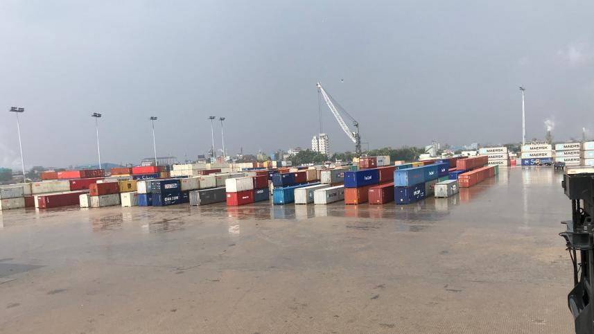
While Chittagong Port remains the main gateway, the challenge extends beyond a single port. Mongla and Payra face similar conditions, and inland waterways managed by the Bangladesh Inland Water Transport Authority (BIWTA) are equally affected. During the dry season, reduced river flow accelerates shoaling, narrowing channels and limiting draft. Since ports and inland routes form one integrated logistics system, disruption in one part inevitably affects the whole.
The Sandwip Channel and the approaches to Bhasan Char highlight this challenge clearly. This corridor is essential for connecting seaborne trade with inland river transport, making it a vital artery of the national economy. Maintaining adequate navigable depth, around four metres in key routes, is therefore not merely a technical target but a transport priority. Yet these waterways are highly dynamic, constantly reshaped by currents and sediment movement, making traditional survey intervals insufficient.
Operational experience shows the risks are real. There have been reported incidents of containers being lost overboard while transiting these channels. Though relatively limited, such events can have an outsized impact on perception, particularly among exporters serving time-sensitive markets. In logistics, confidence is critical, and once shaken, it can be slow to rebuild. Grounding incidents, including cases near Pangaon Inland Container Terminal (PICT) and involving vessels operating under Summit Alliance Port Limited, further illustrate how quickly underwater conditions can turn into operational disruption.
When depth information is uncertain, ships must operate cautiously. They may reduce cargo loads, wait for favourable tides, or maintain wider safety margins. The consequences cascade through the system—longer turnaround times, higher freight costs, inefficient berth use, and increased pressure for emergency dredging. Over time, these inefficiencies quietly erode competitiveness as global carriers compare reliability across regional ports.
Globally, maritime systems are shifting from periodic surveys to continuous, real-time monitoring. Modern technologies now allow constant observation of seabed conditions. Sensors installed on jetties and navigation aids can monitor depth around the clock. Tugboats and pilot vessels can collect data during routine operations using compact echo sounders. Autonomous craft can survey critical areas. When integrated through digital platforms, these data streams provide near real-time visibility of channel conditions, enabling faster and more informed decisions.
The value of such systems is clear in advanced ports. During a professional visit to the Port of Rotterdam, what stood out was not only infrastructure but the depth of situational awareness. Decisions were based on continuously updated data, allowing authorities to anticipate changes rather than react to problems. This shift towards predictive management has become a defining feature of modern port operations.
Across Asia, similar trends are emerging. India has introduced digital platforms to improve dredging oversight and coordination. Vietnam is advancing towards integrated, technology-driven ports with centralised data systems. Pakistan is exploring enhanced monitoring alongside expanding dredging capacity. The direction is unmistakable: maritime competitiveness increasingly depends on data-driven awareness.
Bangladesh is not starting from zero. Ports already operate tugboats and pilot vessels, while BIWTA manages a wide network of inland service craft. With relatively modest upgrades, these assets could be equipped with monitoring tools, effectively transforming routine vessel movements into a continuous data collection network. This approach allows gradual development of real-time hydrographic capability without heavy upfront investment in new survey fleets.
The benefits would be substantial. Continuous monitoring enables early detection of shoaling, allowing dredging to be targeted where it is most needed. It improves navigational safety, reduces the likelihood of grounding or cargo loss, and supports better planning. In turn, this enhances efficiency across the entire transport chain.
Cost concerns are understandable, but they must be viewed in context. Bangladesh already spends heavily on maintenance dredging, while emergency dredging is even more costly. At the same time, delays and inefficiencies increase logistics expenses for exporters and importers, ultimately affecting national trade competitiveness. Compared to these recurring costs, investment in better monitoring is modest. Real-time hydrography should therefore be seen not as a luxury but as an efficient investment.
A phased approach would be both practical and effective. Pilot projects can begin in high-siltation corridors such as Sandwip. Existing vessels can be equipped with sensors, fixed monitoring points installed at key shoaling hotspots, and a shared data platform developed for port authorities and BIWTA. Collaboration with experienced technology partners can accelerate implementation while supporting knowledge transfer.
Ultimately, this is not just about technology. It is about how Bangladesh chooses to manage its waterways in an increasingly competitive global environment. A system that understands its underwater conditions in real time operates with greater confidence. Pilots navigate more safely, engineers plan dredging more scientifically, and shipping lines gain trust in reliability.
Bangladesh has already demonstrated ambition in expanding port infrastructure and strengthening logistics networks. The next step is to modernise management by embracing data-driven decision-making. Real-time hydrography is rapidly becoming a global standard.
On this World Hydrography Day, the message is clear. The waters beneath Bangladesh’s ships are constantly changing, and our ability to monitor them must evolve just as quickly. By embracing real-time hydrography across seaports and inland waterways, Bangladesh can enhance safety, reduce long-term costs, and strengthen its position in global trade.
In maritime operations, the greatest risks are often the ones we cannot see. That is precisely why seeing beneath the surface in real time has become a strategic imperative.
Ahamedul Karim Chowdhury is adjunct faculty member at Bangladesh Maritime University.


Comments