How earthquakes, disease and war shaped Bengal’s slave trade

Medieval Bengal was known for riverine shifts. That deadly earthquakes played a part in this morphological instability is not so well known. This article speculates that these were no less important than rivers in Bengal’s geomorphology. Changes in the Himalayas generated physical pressures that contributed to the seventeenth-century slave raids in Bengal. The fact that sixteenth-century records do not refer to such raids reinforces our argument.
Earthquakes
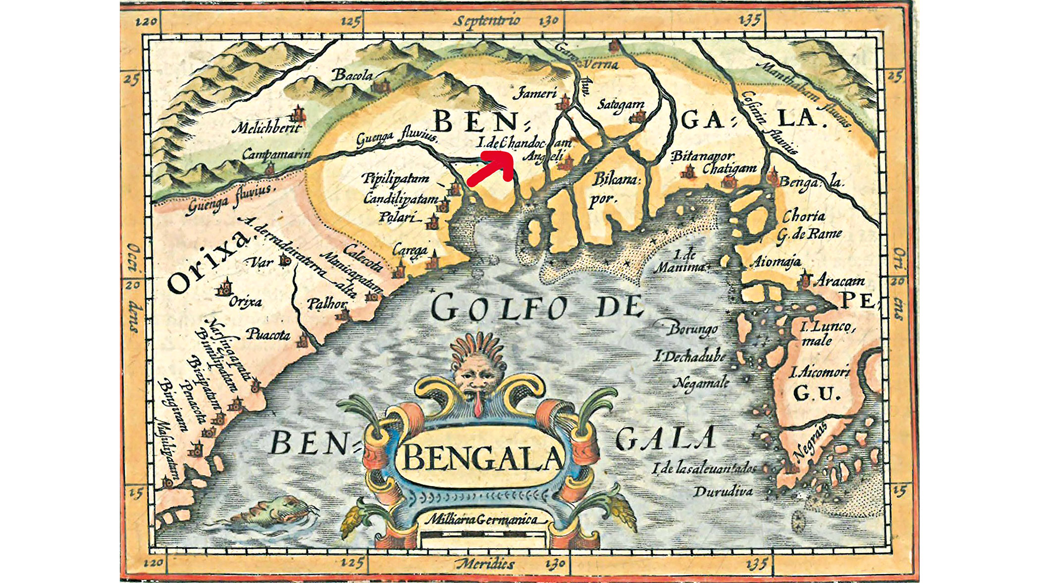
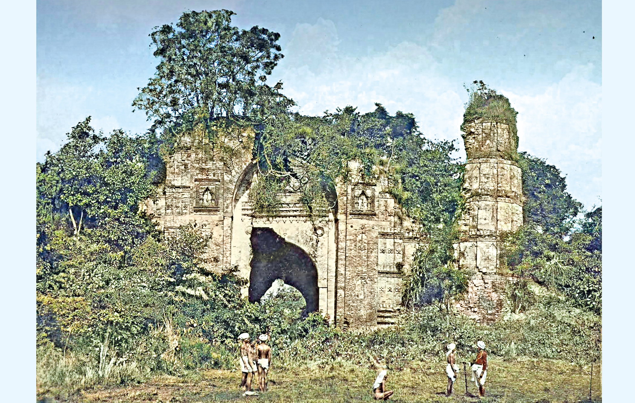
Earthquakes, which have been less studied in relation to Bengal (we generally concentrate on riverine shifts and cyclones), contribute to morphological instability in Bengal even today. We have historical records of a severe earthquake in 1505 that caused changes in the course of the Ganges River system. It flooded the first city of Gaur. Lying on the interfluve between the Kalindri and Bhagirathi rivers, Gaur became filled with swamps that bred mosquitoes. Plagued by malaria, it was abandoned in 1575. Later in the sixteenth century, the second city of Gaur was built on the opposite bank of the Bhagirathi River.
The earthquake of 1505 was linked, surprisingly, to changes in the western Himalayas rather than the eastern Himalayas, as one might expect. This calamity was part of a sequence of significant earthquakes occurring throughout the Himalayas in the sixteenth century—Kashmir in 1501, followed by two events a month apart in Afghanistan and the central Himalayas, concluding with a large earthquake in Kashmir in 1555. Roger Bilham suggests that the western Himalayas may have slipped in a sequence of events during this period.
The Kumaon/western Nepal earthquake of June 6, 1505 caused substantial damage in northern India and affected several towns along the Ganges. How the Brahmaputra fared is unknown. Not seen as a holy river because its source lies outside India, it is ignored in the selective ranking of rivers in Puranic lore.
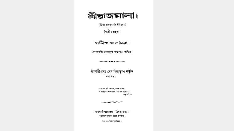
Smaller seismic gaps were evident in Kashmir, Sikkim and Assam during this period, but the historical record relating to them is either ambiguous or absent. Tripura’s Sri Rajmala mentions an earthquake in the context of an Arakan raid: ‘Dogs and jackals were howling in towns and market places. Village deities shed tears day and night. The fall of meteors, people and earthquakes took place.’
Unstable mountains
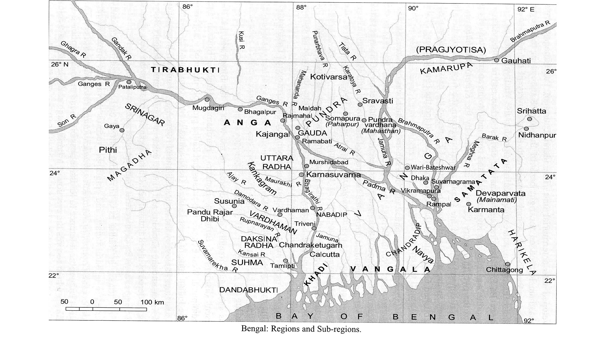
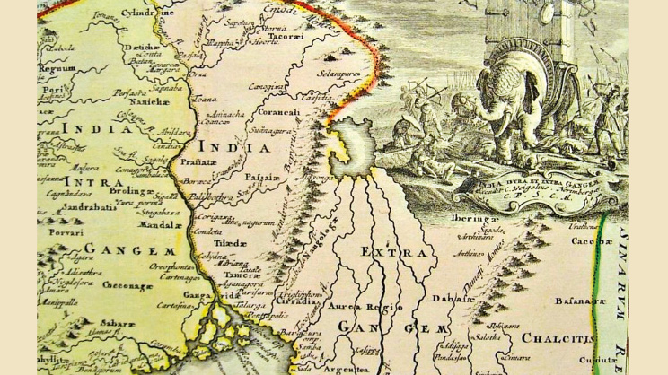
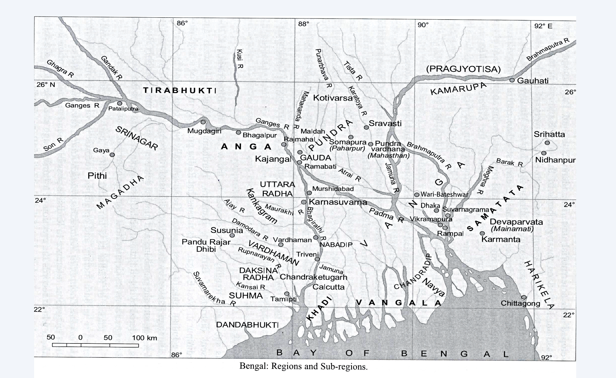
The delta is shaped like a funnel, with its open mouth pointing towards the Bay of Bengal. To the north, southeast Bengal connects through its rivers to the eastern Himalayas, linking it to Tripura, Assam, Manipur and Nepal. However, since the entire mountainous region was unknown to contemporary mapmakers (who were based in Europe and relied solely on travellers’ reports), the northern region was depicted in a highly compressed form, leading abruptly to what were called the ‘Emodes’, the ‘Caucasian’ and finally the ‘Tartarian’ Mountains, names then used for the Himalayas. The lesser mountain chains—the Garo, Khasi and Lushai Hills—were unknown and rarely depicted.
Fictitious lakes
Europe was unfamiliar with Asian mountain systems. Yet, in the mapmaker’s imagination, rivers in Asia were believed to flow from a common source and, if this could not be a glacier, it was assumed to be a lake in the mountains. The lakes of Tibet as possible sources of Asian rivers entered the cartographic imagination.
One such lake was the mythic Lake Chiamay, which was believed to give rise to four of Asia’s most important rivers: the Indus, the Ganges, the Mekong and the Yangtze. Lago de Chiamay first appears on Giacomo Gastaldi’s map Terza Tavola in Ramusio’s Delle Navigationi et Viaggi (1554). Matteo Ricci’s world map (1602) depicted a very large lake, Chia Hu, which was supposed to be Lake Chiamay. It was shown as giving rise to four almost parallel rivers: An-i-Ho (the Ganges), which ‘receives thirty streams and carries golden sand’; another flowing over eastern Bengal (possibly the Karatoya or ‘Caor’ of early modern European cartography, or perhaps the Brahmaputra); a third called the River of Golden Sand (a name still applied to the Upper Yangtze), which passed through Burma and united with a fourth, unnamed river before reaching the sea. This became the new, authoritative cartographic ‘truth’.
It seems likely that Ricci obtained this information from Bon Po and Buddhist doctrines, as well as from Antonio de Faria y Sousa’s works of 1543, and from Gastaldi, Fernão Mendes Pinto and João de Barros.
But misperceptions about Asian river systems, and the confusion they created, were reflected in the number of rivers that Chiamay was believed to generate. The Mercator-Hondius map (1606) showed not four but five rivers issuing from it. As late as 1720, Christoph Weigel reproduced the five-river scheme. However, Joan Blaeu wrote in Le Grand Atlas: Cosmographie Blaviane (1663) that Lake Chiamay, situated towards Tartary, gave birth to six great rivers, one of them passing through the ‘kingdom of Caor’ (Kamrup, predating the Ahom polity), from which it took its name, and which also passed through Kamta and Sylhet.
His father, the well-known cartographer Willem Blaeu, however, had depicted five rivers in 1643. Thus, this mythic lake underwent constant multiplication, influencing perceptions of river systems in the cartographic imagination.
Deadly marginalisation
Lake Chiamay contained the headwaters of significant waterways, an idea that still resonates in local belief. But the delta’s borderland status (it merits mention only in secondary or minor Upapuranas such as the Markandeya and Kalika Puranas) meant that the Ganges’ headwaters from Mansarovar Lake (Kailash’s mythical Brahmakund) were downplayed or totally disregarded.
John Hodgson’s explorations of 1815–16 effectively foregrounded Gaumukh in the northern Himalayas as the source. However, this was not always the accepted view. The explorer Sven Hedin and Clements Markham, President of the Royal Geographical Society, saw the Ganges rising in ‘Great Tibet’, where the Tsang-po (Brahmaputra) also originated. This was an old belief.
Niccolao Manucci’s annalist François Catrou wrote that Indians since Akbar’s time believed in the Ganges’ eastern source, averring that the river ‘rises much higher in the Country towards the middle of Great Tartary’. Rughesi’s Tavola XXII (1597) depicted the Ganges issuing from ‘Cardandan’ or Yunnan. As explorers continued to advocate the Ganges’ eastern source, the mountain-lake-river imaginary made southeast Bengal’s boundaries progressively elastic.
Elasticity
The southeast was labelled ‘Bengala’ or ‘Bangala’. ‘Bengala’ lay within ‘India Beyond the Ganges’, and the Chinese designation of Bagan’s ruler as king of ‘Mien (Burma) and Bengala’ suggests that the two were viewed by contemporaries as an ecologically compatible political-cultural unit.
The Ramusio map (1554), Gastaldi’s map (1561) and an Armenian map (1695) depicted ‘Bengala’ and ‘Machin’ or ‘Macin Regi’ as contiguous units. Maha Chin was the name by which Bagan’s successor, the Ava kingdom, was known. Abraham Ortelius’ ‘Asia’ in Theatrum Orbis Terrarum (1570), using data from Marco Polo’s Travels, showcased this area through the Ganges, uniting Bengal, Ava, Yunnan and China.
Gerhard Mercator (Gerard Jr.) published a map of Asia (1595) in which the Ganges flowed through India’s northeast, then turned southeast, and finally entered the sea through a Chinese coast highlighted earlier by Ortelius, a coast that had ‘Cantan fl. olim Ganges’ on it, following Fra Mauro. However, his world map (1450) showed ‘Macin-Bangala’ as one unit. How do we read these connections when studying the southeast?
Northeast pressures
The southeast was not only elastic, it was marginal. Raiding occurred not only because of physical pressures but also because of certain trends visible across the Bay world: rising international trade and a growing labour market created mobility through both forced and unforced migration. These developments, in turn, accelerated competition for resources, generated chronic warfare and resulted in slavery.
Slave raiding in Bengal also occurred in the context of drastic changes to the north, where the trade circuits that were increasingly enmeshing the Bay world are less visible.
‘North’ refers to the Tripura, Ahom, Manipur, Koch, Cachar, Ava and Arakan kingdoms. War was endemic to their political systems, and slaves taken as booty functioned as cash within those systems. Two processes are visible: the gradual concentration of power within a centre or dynasty, typically situated in the highlands, and the decentralisation of military labour mustered by royal order. Labour decentralisation meant increased raiding, which in turn fuelled the war machine. The Manipur court appointed slaves to work as buglers, drummers, dhobis, horse syces and elephant mahouts. Tripura used Arakanese slaves to clear jungles. The drive to amass and control labour propelled the war machinery.
These traditional slave-owning societies were increasingly unable to cope with expansionary trends such as urbanisation, monetisation and growing commercialisation emanating from southwest China (Yunnan, attached to China from the Ming period) and Mughal Bengal.
Mughal and Chinese campaigns hastened the process of decline, as technological obsolescence outpaced military growth. From once-expansive states, they degenerated into weakened communities wracked by disease and famine. In many cases, as in Sylhet, human captives were traded or used as levies or tribute in the absence of a cash economy in the region.
Significantly, a labour market developed within this system. Sri Rajmala records that the wages of sixteenth-century military levies were based on the monetised values of booty. A goat cost 2 annas, a cow 4 annas, and a human 16 annas. This rendering of values in monetary terms meant that military levies from neighbouring subject states could be paid in slaves. Sylhet, for example, paid military levies to Tripura in captives. Captives thus entered the world of circulation as money, reward, tribute and fines within the northeast. Not only royal courts but temples and monasteries also used captives as mobile wealth. Thus, it was not only international trade that promoted slavery; slavery expanded in many parts of South Asia because of the need to transfer tribute. Such human assets were readily available from the chronic raids and wars that characterised the region.
War and disease
With a rising population, expanding commercialisation, vibrant trade, the introduction of new styles of warfare (the transition from cavalry-based warfare to gun-equipped troop warfare), new diseases—especially smallpox—and the frequent occurrence of famine, the region became politically volatile. Manipur seems to have borne the brunt of these pressures. Ava attacked Manipur in 1648, 1651 and 1692. Manipur attacked Ava in 1597, Mogaung in 1614, and possibly Mogaung again in 1647. In alliance with Mogaung, Manipur raided another Shan realm, Kyang of Kapo (Kabaw in Myanmar), in 1263, 1467, 1558, 1572, 1585, 1592, 1602, 1610, 1614, 1647 and 1688. Kapo was crucial to Manipur; it lay in a river valley that had to be crossed to gain access to Ava. Entries for 1684 and 1685 in Manipur’s court chronicle, the Cheitharon Kumpapa, suggest that Kapo was subordinate to Manipur, although it had attacked Manipur in 1542.
Military campaigns did not just dislocate communities. Riverine shifts left swamps and marshes, which contributed to recurring disease. The court chronicles of Assam, Tripura and Manipur report an escalation in livestock pestilences and smallpox epidemics. Manipur recorded cattle and horse epidemics in 1520, 1531, 1534, 1535, 1541, 1574, 1581, 1651, 1654, 1660, 1672, 1685 and 1699. Ahom Buranji recorded cattle pestilences in 1534 and 1618, and a cholera epidemic in 1663 amidst the devastation caused by Mughal campaigns.
Smallpox was particularly severe. Several Tripuri kings died of the disease: Dharma Manikya (1462), Dhanya Manikya (date uncertain), Vijay Manikya (date unknown), and Nakshatra (Chatra Manikya) in the 1670s. The references to smallpox recorded in Sri Rajmala were probably allegorical representations of sinners, unbelievers or pagans, since it is not mentioned as the cause of death in the case of those kings who were recorded as having been cremated according to Hindu rites. For the Ahoms, smallpox is recorded for the years 1574 and 1637. Manipur experienced smallpox epidemics in 1520, 1531, 1541, 1581, 1651, 1672, 1685 and 1699.
Non-place
Demographic trends help explain long-term processes on the coast and in upland South Asia. Economic expansion, the use of firearms, and provincial reorganisation had rendered post-sixteenth-century empires considerably more stable, but the trend reversed thereafter. Along with maritime decay and commercial decline triggering the seventeenth-century crisis, an expanding population from the mid-sixteenth century resulted in population pressure and a resource crunch that fuelled the slave trade. Ahom Buranji, Fathiyya-i-Ibriyya and the Dutch traveller Glanius noted a particularly severe famine in the southeast and Assam between 1662 and 1666, following the Assam famine of 1643. Manipur experienced famines in 1633, 1634, 1641, 1662, 1670, 1687 and 1690.
Our memory of this political and social vulnerability has much to do with our neglect of the region’s geomorphological instability. The northeast’s troubled economy was always peripheral to Mughal and British interests. Never mind that the 1523 Ahom campaign against the Chutiyas brought in gold, silver, elephants, horses, cattle, firearms and slaves. Skilled artisans were transferred to Assam in large numbers: bell-metal workers, goldsmiths, blacksmiths, oil pressers, gardeners, washermen and weavers. Manipur’s victory over the Mayangs (Cachar, Sylhet or southeastern Bengal—it is not clear) in 1606 brought in 30 elephants and 1,000 Bengali Muslims, mainly swordsmiths, brass smiths, makers of trumpets and long drums, washermen and bracelet makers.
Commercialisation is evident in King Meetingu Khakempa’s inauguration of ten markets in 1614; some sold grain, some sold foodstuffs, while others sold garments or baskets. The northeast was neither poor nor passive, but if a place can be defined as relational, historical and concerned with identity, then a space that cannot be defined as such becomes a non-place.
Although the delta physically consolidated from the nineteenth century onwards, it too remained a non-place. Historical memory equates it with the ‘wild lands’ of the Sundarbans. Mughal unification, consisting of a series of nuclear zones of power in upland western Bengal with the desired combination of agricultural surpluses, vast grazing lands and access to major trade routes, had exacerbated this divide with southeast Bengal. Its robust mercantile economy lay outside the political spectrum. Swamps and forests formed natural frontiers but remained marginal to empire; expansion was possible only in those parts of Monsoon India that were accessible by riverboats. Hence the historical neglect of what is now India’s northeast and our view of the southeast as a passive, raided space.
Rila Mukherjee is a historian and the author of India in the Indian Ocean World: From the Earliest Times to 1800 (Springer Nature, 2022) and Europe in the World from 1350 to 1650 (Springer Nature, 2025).
This is the second part of a four-part series on Bengal’s slave trade.
Send your articles for Slow Reads to slowreads@thedailystar.net. Check out our submission guidelines for details.
Professor Anisur Rahman: The economist who put people at the centre
APO 433: Dhaka’s forgotten post office of World War II
Dadabhai Naoroji: The man who exposed the economics of British colonialism

Untold stories of 1971 through private letters
The extraordinary journey of Atish Dipankar Srigyan

Forgotten story of Jeanette Van Tassel, the American woman who flew over Dhaka in 1892
Beyond 1947 / A personal essay
Abul Mansur Ahmad / A global quest in search of a nation

Chand Bibi and the forgotten history of Muslim women’s political resistance