The untold history of the rivers that connect Bangladesh and Asia

The Daily Star (TDS): How did your interest in this book first arise? Could you tell us about its intellectual origins, the inspirations behind it, and the broader perspective that shaped the project?
Iftekhar Iqbal (II): I have been trying to work on the environmental history of Bangladesh for a long time. My first book was The Bengal Delta: Ecology, State and Social Change, 1840–1943. It was released several years ago. At that time, I was working from a regional perspective on the Bengal Delta—how we can view the development of the Bengal Delta’s environmental history during the colonial era. After finishing that, it occurred to me that the Bengal Delta is part of a broader ecological regime. One cannot think of the Bengal Delta, its rivers, and their source regions without considering the highland Tibetan-Himalayan river ranges.
It then occurred to me that the deltas at the end of each big Asian river—the Bengal Delta, the Burmese (Irrawaddy) Delta, the Red River Delta, the Mekong Delta—have a history that we might be able to connect. This inter-delta relationship exists through the entire course of the history of rivers. I wondered if there was a way to look at my regional work on the Bengal Delta on a larger scale. In that context, I began working on these six rivers: the Brahmaputra, Irrawaddy, Salween, Mekong, Red, and Yangtze. I thought about how to move from a regional to a trans-regional dimension. Interestingly, I was able to gather enough material to write about the inter-regional relationship of these six rivers, and then began writing it. It has taken a long time because it was methodologically very challenging, but it has finally been published.
TDS: Your book focuses on six Tibetan-sourced rivers—the Brahmaputra, Irrawaddy, Salween, Mekong, Red, and Yangtze (BISMRY collectively)—these six rivers probably represent the largest river connectivity. How is this connectivity linked to the post-colonial states of different Asian countries?
II: If we think about the historiography of rivers, we can see good work on individual rivers. Some studies have focused on the Ganges or the Brahmaputra, and Arupjyoti Saikia’s work is one example. I have tried to see if there is an interrelationship between them. You find sufficient material within the Tibetan-Himalayan rivers. If we think of them as post-colonial countries, these rivers pass through nine or ten countries—Bangladesh, India, Yunnan (China), Laos, Thailand, Cambodia, and so on. This provided an opportunity to contrast how, during the imperial era, when empires (especially the French and British) controlled most of this landscape, at that time how the relations between humans and rivers, otherwise more-than-human agency and actors, worked out. How did the river interaction happen? It allows for a comparison with the post-colonial era—how the dynamics change during the post-colonial state, and eventually how the post-colonial states disrupt that continuity.
TDS: Your work discusses concepts such as “Fluvial Asia” and “Ecological Commons” and their interaction. The nature of ecological commons appears to have changed from the pre-colonial to the post-colonial period, shaped significantly by interventions of imperial agencies. Could you elaborate on the concept of fluvial commons as presented in your book?
II: The concept of fluvial commons is a prominent idea in this book. I am trying to say that in the growth or the cultural, economic, and political development of Asia over the last few centuries, the river was a central element. Many people compare this to the Mediterranean world—specifically the great works of Braudel. There, centring on the Mediterranean, he spoke of river connections—how certain rivers connect those regions to the Mediterranean Ocean and the sea. I saw that the Asian rivers are much larger and more perennial than those in the Mediterranean world, yet their history has not surfaced in the same way. For instance, much work has been done on oceanic history (like the Indian Ocean) or mountain history (like the Himalayas or Tibet). Willem van Schendel worked on this and named it ‘Zomia’—the idea of a mountainous, separatist, or isolationist identity. James Scott has also done important work on this.
While work has been done on various landscapes—oceanic, mountainous, plain land, or deltas distinctively—however, there is a lack of interconnected works on these diverse landscapes. I realised that an interconnected landscape is possible if we use the rivers and look through an integrated lens. I saw that the river covers the sea and connects the mountains with the sea, valleys, and deltas; the rivers act as a connecting thread between different landscapes. Then I realised, why not pursue this entire range of rivers? Thus, I saw that mainland Southeast Asia, Eastern South Asia, and Western China comprise a massive river network that we can name something; in this context, we call it ‘Fluvial Asia’.
TDS: How the connected movement of power, people, commodities, and species turned these river systems into boundless sites of the commons. You describe these riverine networks as an “ecological commons.” Could you please explain what you mean by ecological commons in this context?
II: The concept of the “ecological commons” is connected to the idea of “Fluvial Asia” in this book. We are defining the commons as something that is connectable to many elements and actors. It was possible for the river to unite everyone. For example, consider the confluence of rivers—where a small river meets a large one. In these places, many markets and bazaars developed. This applies to every river and became a meeting place for various ethnic groups, commercial agents, political government officers, and boatmen. It became a common meeting place for different people.
Furthermore, there was a coordination of power. Imperial forces, like the British, could navigate certain parts of the river, but as they went further upstream, the rivers became narrower and more rapid, reducing navigability. They could not remain easily mobile. At that point, another power—social or political—emerged, as ethnic groups could not be easily displaced by the empire. For this reason, the empire came into a conversation with the local or ethnic communities. No one had an absolute monopoly over the river, and no one was entirely displaced. This forced negotiation and conversation, creating a platform for the commons.
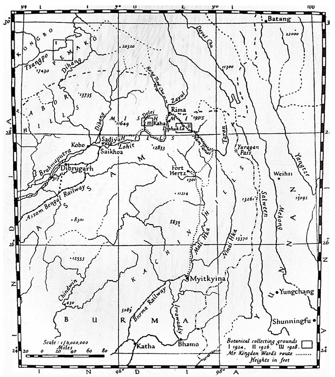
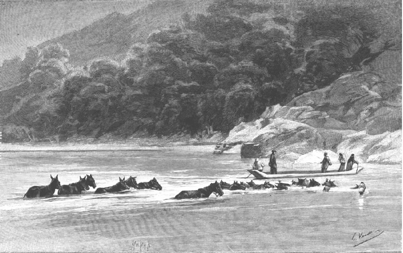
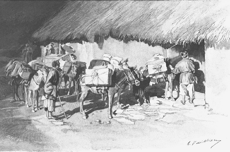
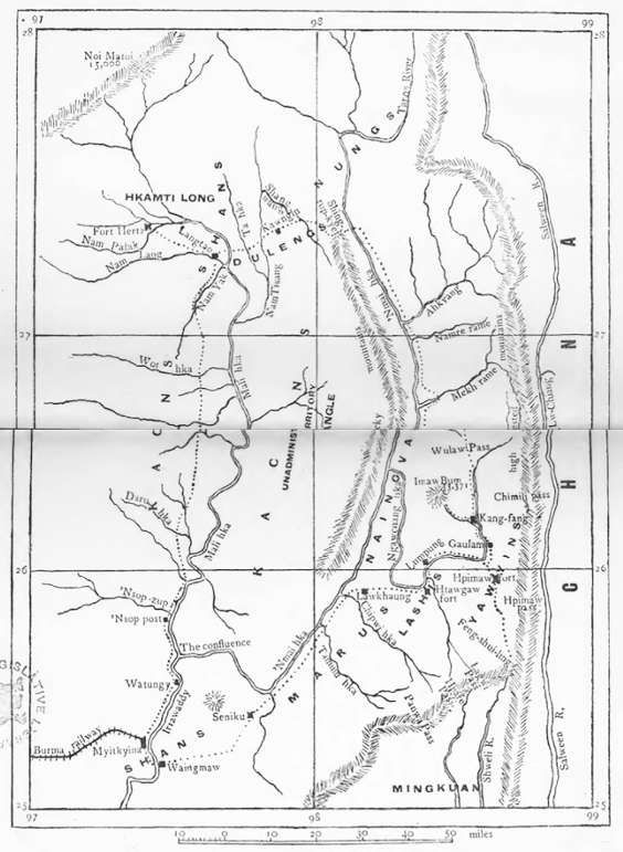
Another interesting aspect is the non-human elements. As you go upstream from the deltas, the elevation of the landscape increases, rivers narrow, and human mobility between valleys decreases. So the point is: how do you connect so many rivers through this rugged area near Yunnan? These six rivers—the Brahmaputra, Irrawaddy, Salween, Mekong, Red, and Yangtze—all come within 200 kilometres of each other near Yunnan. This area is very inaccessible. Here, we see a non-human agency or actor: the mule (khachchor in Bengali). These mules were the only way to travel between the navigable points of different rivers in these rugged, inaccessible inter-valley regions. Thus, the mule became an element of the commons. Together, human and non-human, power and the peripheral, they formed a commons.
This concept is particularly important because, in the post-colonial era, after Asian countries gained independence, they accepted the maps created by imperial forces as the definitive political boundaries. We forgot that the river was commons; it was for everyone. There was a tension around it. That tension continues today between China and downstream countries, or between India and downstream countries, particularly Bangladesh. The 'de-commonisation' of these rivers led to these tensions. What we call decolonisation is all right, but alongside that, the de-commonisation of the rivers is also happening.
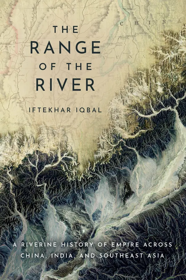
A significant reason behind writing The Range of the River was that I felt it was very important to uncover this. For instance, whatever fragmentations are happening—as what once was a commons is now de-commoned. This de-commonisation has an adverse impact, leading to interstate tensions, political crises, and ecological or biodiversity issues arising. Once, it was not like that. It was more sustainable. If we can recover the history of how these were once more sustainable, we might view current crises with a new perspective. That was another context for writing the book.
TDS: I want to return to the Brahmaputra. Specifically, how was the Brahmaputra previously connected to this collective transboundary river network, and how was it affected by nationalised boundaries?
II: The Brahmaputra is a very interesting case; it can be taken as a model among these six rivers. The chapter title is ‘Brahmaputra: A journey with the son of the creator of the universe’. This journey is interesting because the Brahmaputra is local and regional, yet at the same time, it is a trans-regional river. It is local in the sense that those in its basin rely on it for their livelihoods and economy. But it flourished because of its trans-regional dimension. It is trans-regional in this sense. A part of the Brahmaputra comes through Tibet—Yarlung Tsangpo. Then it connects with the Lohit above Assam, and then becomes the Brahmaputra. Numerous rivers from different places join together; Tista is one of them, coming together. Two rivers, like the Yarlung Tsangpo and the Lohit, and tributaries and branches come from Tibet, the northern sides of Yunnan. If we look at the other side, then small rivers from Burma also join. Geographically, it unites three regions, three cultures, three societies, and three states or sovereignties. Along with the water came commodities, people, and ethnic groups. There was a flow of culture and economic commodities.
In the mid-19th century, Sirajganj was probably the largest river port in South Asia—either Narayanganj or Sirajganj. The Indus or the Ganges did not have this level of connectivity. We see through that river connectivity Sufi-Pirs coming from Baghdad—like Nasiruddin Baghdadi, who met Maulana Bhashani in Sirajganj. Maulana Bhashani became his disciple there. This demonstrates the centrality of the river—connecting the Bay of Bengal and the Indian Ocean with the Ganges in North India, and simultaneously with China, Tibet, and Burma. This was a central place. We would say the heartland of the Bengal Delta was that area around Sirajganj and Goalundo. In this way, we can say the Brahmaputra worked as connectivity with other cultures.
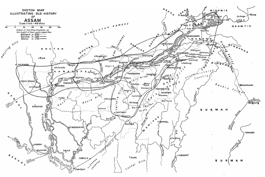
British records show how vibrant that area was with its massive markets. In the late 19th century, the population along the Brahmaputra was about a quarter of Dhaka's—a significant number for a place we would call 'remote' at that time. It had huge significance. Bengal Viceroy, Richard Temple, visited and described that place as "it’s a town without houses"—everything was there: people, trade, everything was happening, no houses or infrastructure, but everything happening through boats. There were 50,000 to 60,000 registered boats. This is one part, while the Brahmaputra confluence with Padma continues to the south. Further, if you go north, in Assam or Guwahati, and other areas, it is even more connected through tributaries.
In the imperial era, the British had a project to connect the easternmost part of the Brahmaputra with the westernmost part of the Yangtze (about 200–250 km). They wanted to create connectivity. It did not happen, though; however, the idea or thought of river connectivity was there during the colonial era. But the idea of river connectivity was a borrowed idea for the British. Borrowed in the sense that the connectivity existed long before the imperial era. The pre-imperial history of humans, local, and ethnic groups showed that they had been using these river routes since prehistoric times. The river connectivity was there. However, the imperial idea simply tried to achieve that connectivity for their own purposes. Even though the British couldn't do it their way, they had to engage in conversation with the locals; they had to enter into negotiation with the locals. We can see that the Brahmaputra had a focus on interactive, interconnected, and trans-regional connectivity. That connectivity spanned across China, Tibet, Burma, and North India through the Ganga. For this reason, the Brahmaputra was a very important nerve line for South Asia, and for Bangladesh, of course.
TDS: On the question of agency—imperial agency, local communities, or indigenous communities—there is also more-than-human agency, like the river. We often think history is created only by humans. How do nature, landscape, and geography contribute as active agents in your collective river network?
II: The idea of river agency is not new, but we are unfamiliar with it because human agency dominates our knowledge practices; as a result, we skip river agency. We assume history is only about kings, emperors, or praja—we think history means human history. Many scholars now argue that history is not just about human history. The universe/world lies beyond the human; suppose the non-human, more-than-human, or equal-to-human. It is impossible to write human history without the non-human or more-than-human agent. If you say, early agriculture was impossible without animal labour. Even if we consider AI (Artificial Intelligence) today, it’s an artificial interline, but we cannot deny the truth that however far humans have created the knowledge base till now, it is essentially a collection of that knowledge. We cannot write history while disconnecting animals, biodiversity, landscapes, or rivers. These facts are increasingly receiving attention in the writing of history now.
To write human history, we must include non-human actors. Some call this 'Deep History'—seeing humans as just one of thousands of species. But the ecological world alongside humans, the history of the inhabitants—the non-human—of the other ecological world is equally important. This is called deep history, in which humans are one of many species. This deep ecological history stands in opposition to anthropocentric (human-centric) history. Animal history is being written (e.g., how horses shaped the world), and similarly, inanimate things like rivers are being viewed as agents.
In the pre-modern understanding of rivers, while we know that civilisations were built around rivers such as the Nile and the Indus, the new dimension is that rivers are not merely passive providers of irrigation; they are active agents in shaping human societies. Rabindranath Tagore has a long poem titled 'River' where he describes the river calling out to us, extending both arms. That appealing impulse gives a realisation within poetic imagination about river agency. Climate historians also say rivers have memory—registering past weather and cloud formations. Rivers know everything because rivers are tied to rain and cloud. We can say that, if we see the river through the perspective of environmental humanities. Toni Morrison wrote about the river, saying that the river knows where it was yesterday, where the river visited yesterday through floods, it occupies its old places and leaves its mark. This is actually the river’s place; next year the river will again visit those places. In so many ways, we can consider river agency.
However, politically, for instance, the British Empire could not do whatever they wanted to do with the river. They had to move according to the river—centring the river. Sometimes they succeeded, sometimes they did not. In this context of mainstream history, the river has an agency. Today, rivers are even being granted legal personhood in places like New Zealand and Bangladesh, acknowledging them as legal entities.
TDS: How does the book challenge the traditional idea that upland and mountain communities were isolated, and what does the concept of “rooted mobility” reveal about their role in regional trade and interaction?
II: The concept of rooted mobility is interesting. Suppose you are travelling from Dhaka to Sirajganj and up the Brahmaputra, or any imperial forces are moving. Eventually, navigability decreases as the landscape rises. However, the flow of commodities cannot be stopped, because it connects interregional trade. Imagine we are moving through the Brahmaputra and its destination is Yunnan, and then onto Chongqing—it’s a big city now—and through the Yangtze towards Shanghai. How is that flow maintained? Consider the connectivity between the Yangtze and Brahmaputra—the flow of trade, ideas and commodities, ethnicity, cultures—how is that maintenance possible? Who made that possible? In these inaccessible regions, the inter-valley regions, the middle parts of the Brahmaputra regions and the Yangtze regions—Yunnan and Sichuan provinces—these are very inaccessible mountain and rugged areas. The ethnic groups living in those areas engage with people in the plains, as well as with state and imperial authorities, because they wish to connect with other river systems such as the Mekong, Irrawaddy and Red River. That is perfectly legitimate. Their position is that they inhabit these regions and, as indigenous communities and ethnic groups, they will continue to maintain the river's flow and remain involved in its management. Groups such as the Kachin, Tai and others have consistently stated: "We will not stop the flow.”
In the rugged mountains of Yunnan or Sichuan, those ethnic groups take this opportunity. They facilitate the flow of goods and people between valleys—acting almost like a relay race. They remain in their own areas but ensure the flow continues. I call this rooted mobility. There is no reason to think that these communities wish to remain isolated, avoid contact with others, or keep themselves separate and independent. That is not the case. They are not "hiding" in the mountains; rather, they seek connections with the wider world and the sea. Because important corridors pass through their territories, they facilitate this mobility. Both land corridors and inter-valley corridors run through their lands. I discuss this in greater detail in The Range of the River.
I must mention the role of the mule, the non-human actor. The mule was the greatest medium for inter-valley communication. And who were the muleteers? The muleteers were often Chinese Muslims from Yunnan. This relationship between man and mule—human and non-human—maintained the connectivity. They dealt with those non-navigable places, making them navigable through the mule and the muleteers. They crossed rugged mountains to reach the next navigable point where boats could take over.
See how non-human elements are so significant in history.
Across tropical or mainland Asia—spanning Southeast Asia, South Asia and western China—the vast region I call Fluvial Asia was shaped by interactions among the powerful and the powerless, humans and non-humans, imperial authorities and local communities. In this expansive riverine world, the networks of communication and exchange among humans, non-humans, empires and ethnic groups constitute what I define as the commons.
TDS: What are the new experiences of the post-colonial period in Bangladesh in terms of river management that are essential to mention?
II: In the post-colonial era, the concept of territorialisation in river management has created tension affecting China, India, Pakistan, and Bangladesh. While the Mekong Commission has achieved a basic level of the commons, such institutional commons have not developed for the Brahmaputra or the Ganges in South Asia. History shows that we were not always in such tension over water because the river was historically constructed as a commons. In the age of technology, capital investment, and neoliberal projects, we are breaking down the river’s agency. In the imperial era, empires needed the rivers to be healthy to maintain the flow of commodities to the sea.
These six rivers were not exploited as heavily as the Ganges or the Yellow River. My research suggests that, in the face of post-colonial tensions and climate change, we must look back at how we historically developed the river as a universal reality or a commons. Thousands of dams have been built. In Bangladesh, we protest the Farakka Barrage, but we often forget that at least 30 to 35 of our 54 rivers have structures on them. More are planned. This damages the commons for humans, wildlife, and biodiversity alike.
TDS: What are the existing problems in historical studies in Bangladesh?
II: Institutionally, we are rich; almost every public college and university has a history department. Thousands of students graduate, but we must consider what kind of history they are studying. We primarily view political history (kings, presidents, prime ministers) as the only significant history. Social and women’s history are emerging, but environmental history is not yet prominent. History is the “science of change” over time. To understand the mechanisms of change, the environment is crucial. We often focus on individuals, but we must look at the structures within which they operate.
TDS: Many rivers are disappearing; how should they be managed?
II: We must apply the concept of the commons locally. The river is a space and an agent connected to the livelihoods of cattle herders, boatmen, and fishermen, as well as millions of non-human actors. By putting up pillars and encroaching on the river, we are killing it because we do not see it as a commons. As Jagadish Chandra Bose said about plants, rivers also have life. We must promote the idea that the river is our life and a commons for all. We need better governance, a humanistic love for the river, and diplomatic conversations, since our rivers are trans-regional. The corporate and capitalist world must also understand that if the river dies, their profit-making machines will also stop. Everyone must come together.
TDS: Could you tell us about your current work?
II: I am currently working on the environmental history of South Asia, tentatively titled Anthropocene in South Asia. I am exploring how human-induced factors from the Mughal era to the present have damaged or changed the environment and what the future implications are.
The interview was taken by Md Raihan Raju. He can be reached at raihanraju29@gmail.com.
Send your articles for Slow Reads to slowreads@thedailystar.net. Check out our submission guidelines for details.

Untold stories of 1971 through private letters
The extraordinary journey of Atish Dipankar Srigyan

Forgotten story of Jeanette Van Tassel, the American woman who flew over Dhaka in 1892
Beyond 1947 / A personal essay
Abul Mansur Ahmad / A global quest in search of a nation

Chand Bibi and the forgotten history of Muslim women’s political resistance

Women’s voices in Nazrul’s Dhumketu
How Milad-un-Nabi shaped Muslim cultural life in colonial Bengal
What Rashomon teaches us about truth and human behaviour