


River erosion needs a coordinated response
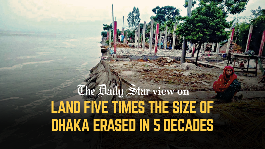
We are alarmed by the scale of river erosion and its consequences for communities living along our riverbanks. According to government data, a staggering 1,585 square kilometres of land has been eroded by the Jamuna, Ganges, and Padma rivers over the past five decades. This is more than five times the combined area of Dhaka's two city corporations. Although around 433 square kilometres have re-emerged as chars, the country has suffered a net loss of about 1,153 square kilometres—nearly four times the size of Dhaka city. A 2020 study estimated that around 100 square kilometres of land is lost to erosion each year. As rivers swallow homes and farmland, families are repeatedly displaced, losing not only their property but also their livelihoods and sense of security.
The Centre for Environmental and Geographic Information Services (CEGIS) estimates that roughly 1,000 people are displaced for every square kilometre of erosion. Unable to rebuild rural livelihoods, displaced families often migrate to cities with little education or marketable skills, finding work as day labourers, domestic workers, or rickshaw-pullers. Many settles in low-lying, flood-prone slums that already house earlier waves of erosion migrants. Bholar Basti in Dhaka's Pallabi area, for instance, is home to more than 30,000 people, most of whom were displaced by erosion and flooding in Bhola. Forced from riverbanks into slums, they remain trapped in poverty and insecurity. Ibrahim Mia, for example, lost his three-acre farmland and home to the Jamuna and eventually moved to Dhaka, where he has worked as a labourer in Karwan Bazar since 2009. Like many other erosion victims, he continues to hope that his land will re-emerge as a char so that he can return to his rural life. His story reflects the uncertainty faced by thousands of families repeatedly uprooted by river erosion.

The government, therefore, needs proper plans to deal with both river erosion and displacement. As CEGIS has been conducting annual erosion forecasts for the Jamuna, Padma, and Ganges since 2004, the government should coordinate with the agency and take timely, implementable measures. Currently, the Bangladesh Water Development Board responds to vulnerable areas primarily by placing sand-filled geobags along riverbanks, often when homes, roads, and other infrastructure are already under threat. It clearly needs to do more. We need a comprehensive national strategy that combines continuous satellite-based monitoring, preventive bank protection, and planned resettlement of highly vulnerable communities.
Moreover, there must be a reliable national database of erosion-displaced people so they can access housing, social protection, livelihood support, and other essential services without much difficulty. Communities should also be involved in identifying vulnerable areas and planning interventions. A recent projection by the Change Initiative estimates that erosion could account for 26.6 percent of climate-related displacement by 2050. The state must therefore ensure that those displaced by rivers are not left on their own.
 For all latest news, follow The Daily Star's Google News channel.
Comments