What Nepal’s flood devastation means for Bangladesh, India and China

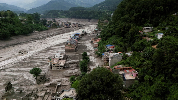
When a wall of water and debris tore down the Bhote Koshi into Nepal's Rasuwa district on Wednesday, killing nearly 400 people across Nepal and Tibet with the toll still rising and over 900 unaccounted for, it exposed something more durable than a single lapse in communication between Kathmandu and Beijing.
It exposed the way early warning is actually structured between upstream and downstream states across the eastern Himalaya: as a diplomatic courtesy, extended when relations are calm and left informal, unsigned or suspended when they are not, rather than as an unconditional floor.
For India and Bangladesh, both permanently downstream of the same glaciated plateau and, in Bangladesh’s case, of India as well, Nepal's flood is not a distant cautionary tale. It is a preview of a flaw underlying their own river relationships with China.
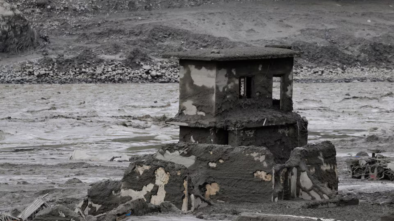
To begin with, the timeline of what happened on Wednesday is more contested than either the Nepali or the Chinese account admits and is worth setting out carefully.
According to Nepali reporting sourced to China's CRI Online Network, the flood struck Tibet's Kerung county around 8.15 am Nepal time; word reached Nepal's disaster authority only some 45 minutes later, and even then not through any government channel but via a phone call from Rasuwa's Chief District Officer, Narendra Pariyar, to the National Disaster Risk Reduction and Management Authority's spokesperson, Shanti Mahat, after locals spotted the rising river.
A separate account from hydrologist Sauhard Joshi of the Department of Hydrology and Meteorology has the flood entering Nepal around 8.40 am and reaching Syabrubesi within ten minutes, with a 16-minute gap between that crossing and the department receiving word through Rasuwa's district administration.
Either way, the instruments meant to catch the signal failed alongside everything else: the automated gauging stations at Bhote Koshi and Syabrubesi, according to senior hydrologist Binod Parajuli, were among the first things the flood swept away.
The honest reading, then, is not that Beijing sat on information it had. It is that neither government had a functioning detection-to-warning chain on the specific 30-kilometre stretch where it mattered, and the "understanding" reached after an almost identical flood in July last year had never been tested by an actual event before Wednesday made the test for them.
Formal notification from the Chinese side, per the same reporting on Nepal News, arrived only at 1.35 pm — close to five hours after the water had crossed the border.
Set against this, the Chinese Embassy's public rebuttal deserves to be taken on its own terms rather than dismissed outright. It denies both that a failure to warn Nepal caused the casualties and that a collapsed "geological disaster dam" on Chinese territory was responsible, maintains that a landslide triggered by an earthquake or an earthquake-like tremor struck both sides of the border simultaneously, and notes, accurately, that Chinese-side losses were also severe.
Mahat's own account corroborates the more measured version: Chinese counterparts, she said, described themselves as equally caught off guard.
The one claim in circulation that does not survive scrutiny is former minister Gokul Baskota's assertion that China had issued a warning a full month earlier — both the Chinese Academy of Sciences' DB Kattel and Joshi call it an unsubstantiated rumour.
The honest reading, then, is not that Beijing sat on information it had. It is that neither government had a functioning detection-to-warning chain on the specific 30-kilometre stretch where it mattered, and the "understanding" reached after an almost identical flood in July last year had never been tested by an actual event before Wednesday made the test for them.
What makes this harder to dismiss is that this was the second catastrophic flood on the same river corridor in 13 months. Each time, the same gap has surfaced: the knowledge exists, but the institutions needed to act on it do not.
Data from International Centre for Integrated Mountain Development (ICIMOD) show glacier loss across the Hindu Kush Himalaya has roughly doubled since 2000; a 2025 transboundary basin assessment flagged 28 glacial lakes as highly susceptible to outburst floods; a separate study this year tracked one Tibetan lake's growth of 194 percent since 1975.
None of this converted into an operating warning system, which is exactly the distinction the World Meteorological Organisation's four-part definition of early warning is built to expose: risk knowledge, monitoring and forecasting, communication, and preparedness to act. Nepal and China had pieces of the first two links and lost the case entirely on the third.
As Reading University's Jeff Da Costa has argued of exactly this kind of event, a warning system does not need the cause confirmed before it acts — an anomalous river reading is sufficient trigger on its own — but that requires a standing, tested cross-border reflex, not a one-page understanding signed after the last disaster and left there.
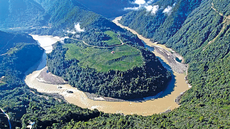
India's position on the Yarlung Tsangpo, as the Brahmaputra is known in Tibet, is the same design flaw at a larger and more institutionalised scale, which ought to be more reassuring and mostly is not.
The Expert Level Mechanism on trans-border rivers, in place since 2006, exists specifically to cover flood-season data and emergency protocols between New Delhi and Beijing — yet it was suspended after the 2017 Doklam standoff and revived only once relations eased the following year, which tells its own story about whether the mechanism is a floor or a favour.
The stakes have since risen considerably: Beijing approved the Medog mega-dam at the Yarlung Tsangpo's "Great Bend" in late 2024, a project expected to become the world's largest hydropower facility, and Chinese geologists themselves published findings this July identifying an active fault line beneath the site. The coincidence in timing this week is hard to ignore.
On the very day Nepal was burying its dead, India's National Security Adviser Ajit Doval met Chinese counterparts in Beijing, and the two sides agreed only that the next Expert Level Mechanism meeting would be held in September — a follow-on from an August 6 round in which India had already sought hydrological data on the river system and technical details of the dam.
India's far more institutionalised channel is, as things stand, still at the stage of formally asking for what Nepal discovered, fatally, that even an "understanding" does not guarantee.
A technical critique from the Observer Research Foundation adds a siting problem that echoes Nepal's exactly: the existing monitoring stations sit upstream of the Great Bend, at a point where the river's discharge more than doubles before it reaches the Indian border, meaning fully functioning cooperation could still be watching the wrong stretch of water.
Arunachal Pradesh's Chief Minister Pema Khandu, has called the project a "ticking water bomb"; Beijing's own assurance that downstream interests will not be harmed is offered, as in Kathmandu, without independently verifiable data behind it.
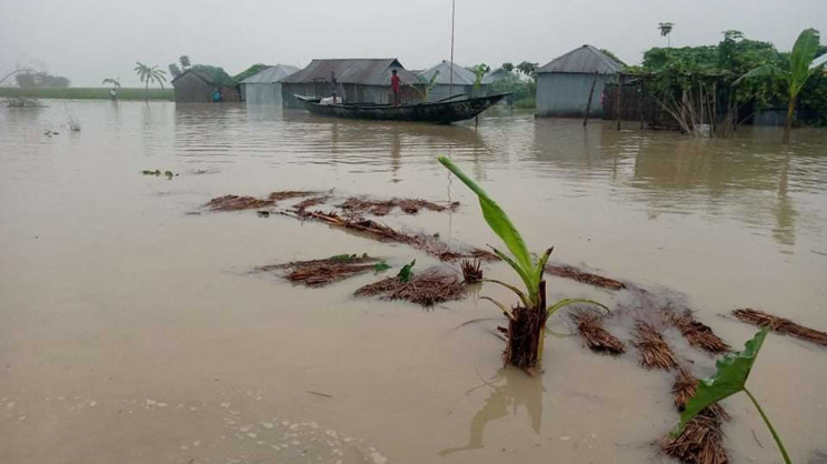
Bangladesh's position is the same problem doubled. On the Brahmaputra, Dhaka is not party to the Expert Level Mechanism at all; it depends entirely on what Beijing shares with New Delhi and what New Delhi, in turn, passes on.
Its own direct engagement with China on the mega-dam has historically amounted to less than negotiation: in August 2023, the foreign ministry's own spokesperson said Dhaka was still gathering information on China's upstream plans rather than formally raising them. However, things changed a bit during the previous interim government when Bangladesh expressed concerns over China’s dam on Brahmaputra.
Proposals for something more adequate exist — there have been calls for a four-country Brahmaputra Commission spanning China, India, Bangladesh and Bhutan, while there have also been arguments that this is a basin-governance question rather than a bilateral irritant.
On the Ganges, the parallel is almost too neat: the 1996 treaty, itself born of the Farakka grievance, expires this December. New Delhi said as recently as this week that any negotiation would proceed through the existing Joint Rivers Commission machinery rather than a redesigned framework built for the hydrological volatility both governments now describe.
But the treaty is no longer simply a bilateral question between Dhaka and New Delhi. Within India, Bihar and West Bengal have their own, and sometimes competing, interests in what happens to the Ganges.
Bihar has begun pressing its claims more forcefully, with Deputy Chief Minister and Water Resources Minister Vijay Kumar Choudhary saying on August 22 that External Affairs Minister S Jaishankar had assured him the state's concerns over Farakka and the treaty would be raised during the renewal process. Bihar says its interests were overlooked when the treaty was signed three decades ago and argues that, despite much of the water reaching Farakka originating in Bihar's catchment areas, the state has not received what it considers its due share for drinking water, irrigation and industry. JD(U) MP Sanjay Kumar Jha has also called for the treaty to be renegotiated.
West Bengal, meanwhile, has a direct stake in the Farakka system and the downstream flow regime. The barrage was built in the state, and Kolkata has long raised concerns over the river's flow, navigation, sedimentation and the management of water reaching the state's river systems. Two years ago, then West Bengal chief minister Mamata Banerjee had even blamed the Farakka Barrage for floods in the state.
Any Indian negotiation with Bangladesh will therefore have to navigate not just what Dhaka wants from the Ganges, but competing demands from the states through which the river and its tributaries flow. That could make renewal considerably more complicated than simply extending a 30-year-old bilateral arrangement.
Even where cooperation functions, it remains constrained by the seasonal limits of formal data exchange. India shares water-level, discharge, forecast and rainfall data with Bangladesh for designated stations on transboundary rivers including the Ganga, Brahmaputra and Teesta; the annual sharing period, previously ending on 15 October, was extended in 2022 to 31 October.
The October 2021 Teesta flood illustrates why that change mattered: flooding began on 20 October, after the old exchange window had closed, and Bangladesh’s Flood Forecasting and Warning Centre said it lacked the upstream Indian water-level data needed to issue a forecast. Bangladesh was then developing a Google-supported digital warning system using BWDB data, but the available official record does not establish that Google smartphone alerts reached Teesta residents during that specific flood before government channels could warn them.
The episode raises a broader question: was the constraint really technical, or is it also a consequence of treating transboundary data-sharing as something to be negotiated between governments rather than guaranteed as a humanitarian necessity? That is the same concern raised by Nepal's unsigned understanding and the Doklam-era suspension of the Expert Level Mechanism.
None of the fixes this implies are particularly exotic. Instruments need to be placed where hazards are most likely to develop rather than at administratively convenient locations; warning protocols should be able to respond to anomalous readings without waiting for the cause to be confirmed; and critical data should be shared year-round rather than only during designated seasons. Monitoring, too, needs to follow the river basin rather than the boundaries of individual agreements.
Rasuwa is not necessarily a case of a government sitting on a warning it could have sent. It may be a more uncomfortable case: the arrangements built after the previous disaster were simply too narrow for the hazard that came next.
A bilateral information-sharing agreement can cover a known stretch of river, but a hazard does not care where an agreement ends. That is the deeper problem visible from the Teesta to the Bhotekoshi: transboundary hydrological monitoring is still largely built around agreements between governments rather than the physical systems they are meant to monitor.
A bilateral information-sharing agreement can cover a known stretch of river, but a hazard does not care where an agreement ends. That is the deeper problem visible from the Teesta to the Bhotekoshi: transboundary hydrological monitoring is still largely built around agreements between governments rather than the physical systems they are meant to monitor.
A settlement can be comprehensive when it is signed and still miss the next event, because the next event may not happen where the settlement was negotiated. Until warning systems are built around where water and ice actually move, rather than around the limits of existing treaties, the region will keep relearning this lesson one valley at a time.
Jannatul Naym Pieal is a Dhaka-based writer, researcher and journalist. He can be reached at jn.pieal@gmail.com.
Send your articles for Slow Reads to slowreads@thedailystar.net. Check out our submission guidelines for details.

Five reasons why Bangladesh shouldn’t join the Mecca Pact
Why Gaza peace deals keep falling apart
Rohingya genocide: Will the ICJ verdict bring justice?

Should Bangladesh join the Mecca Pact?

Documenting Rohingya history / Rohingya repatriation needs more than diplomacy
Nine years on, Rohingya refugees need more than shelter
Myanmar’s partial Rohingya repatriation plan: Another attempt to mislead Bangladesh?

Is Trump’s Gaza peace plan falling apart?
What Japan’s changing Indo-Pacific strategy means for Bangladesh